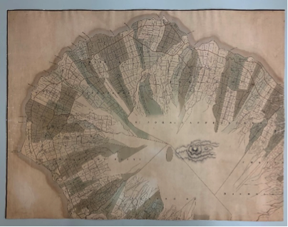
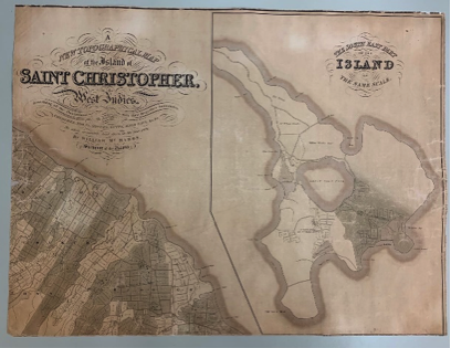
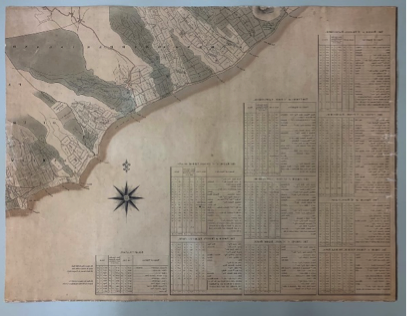
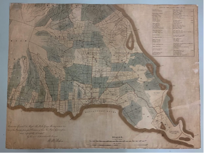
Original 1828 McMahon Map at National Archives, St. Kitts and Nevis
BASSETERRE, St. Kitts, March 24, 2020 (National Archives – St. Kitts and Nevis) – The National Archives now has an original print of the McMahon Map. This map produced by surveyor William McMahon and published in 1828 by Edward Stanford of Charing Cross, London, is the most detailed map of St. Kitts ever produced. It shows, the mountains and numerous rivers and ghauts that score its landscape. It also shows the towns and villages of the island, several roadways and especially, a slightly different island main road that facilitated the transportation of sugar from the estates to the ports for export. McMahon also went a step further by delineating the acreage of the various plantations on St. Kitts, their sugar works and estate houses and locations of the villages of the enslaved. The map was extremely useful when the Sugar Factory decided to lay a railway track to Sandy Point in 1923 and around the rest of the island in 1925. For many years the National Archives has had to make do with photocopies and scans of this invaluable cartographic document, so having an original, safely stored in its collection is a major achievement.
The map was presented to His Excellency Dr Kevin Isaac, High Commissioner for St. Kitts and Nevis to the United Kingdom in March 2019 by representatives of Booker Agriculture International. The company oversaw sugar production in St. Kitts and the Caribbean Region and the map used to be on display at Booker Tate Headquarters in London. In the months that followed, Dr Isaac worked with the National Archives to facilitate the conservation of the map.
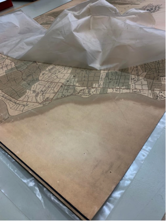
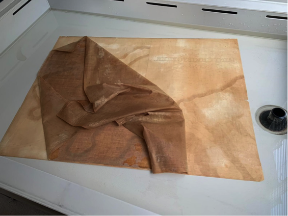
Conservator Anne Bancroft removed the map from the lamination in which it had been placed. This was causing deterioration to the paper on which the map was printed. The adhesive used to stick the map to a backboard for framing had caused damage to the original linen backing that supported the map. It was decided that this too would be removed to prevent further deterioration.
Ms. Bancroft then encapsulated the four parts of the map in mylar in preparation for shipping to St. Kitts and Nevis. The work on the map was made possible through funds from the SIDF, sourced by His Excellency Sir Tapley Seaton, Governor General of St. Kitts and Nevis for the conservation of archival materials.
The National Archives intends to continue providing access through scans to minimize handling of this valuable artifact. The map is now supported in a flat file, in a climate-controlled environment until such time as a safe display area can be found for it. The Director of the National Archives would like to extend her gratitude to all those who have made this acquisition possible.